blah blah blah
The Baldfaces
Length: 9.9 mile loopDifficulty (click for info): Extreme
Elevation Gain: 3600 feet
Rating (click for info): 10/10
Elevation: 3570' (South) and 3610' (North)
Prominence: 300' (South) and 1260' (North)
Driving Directions:
Trailhead and parking area are on Maine Rt. 113 in Chatham, NH. Note: because of the confusion which can arise from two different Rt. 113's (NH 113 and ME 113) being so close to each other, we have given directions for this particular hike from Conway. From the junction of NH 16 and NH 113 in Conway, drive east on NH 113. In 2.0 miles, Rt. 302 joins from the left; continue straight on Rt. 302/113. In 4.7 miles, NH 113 ends, and the road, now only Rt. 302, crosses the Maine border. In 1.1 miles from the border (5.8 miles from jct. 302/113), turn left onto ME 113 (River Street). Drive 1.2 miles (crossing back into NH), then turn right to stay on ME 113, now East Conway Road. In another mile, turn right again to stay on ME 113, now called West Fryeburg Road, crossing back into Maine. In 4.4 miles, turn right one more time to stay on ME 113 where NH 113B continues ahead. In another 3.1 miles, NH 113B enters from the left, the name of the road changes to Main Road, and it crosses the state line back into NH. Continue 2.7 miles, and turn right into a large parking area, clearly marked for Baldface Circle Trail.
About the Hike:
The spectacular loop over the Baldfaces provides some of the most enjoyable open ledge hiking in the White Mountains. In addition to the stunning vistas of a more remote corner of the White Mountains from the two open summits of South and North Baldface, there is almost four miles of hiking with views all around you. If that's not enough, there are also two beautiful waterfalls to see along the way! Be aware, however, that the climb to South Baldface involves much difficult climbing over steep ledges which can be very dangerous when wet.
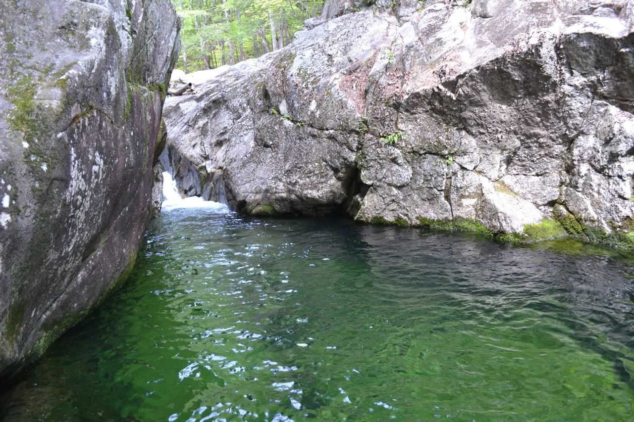
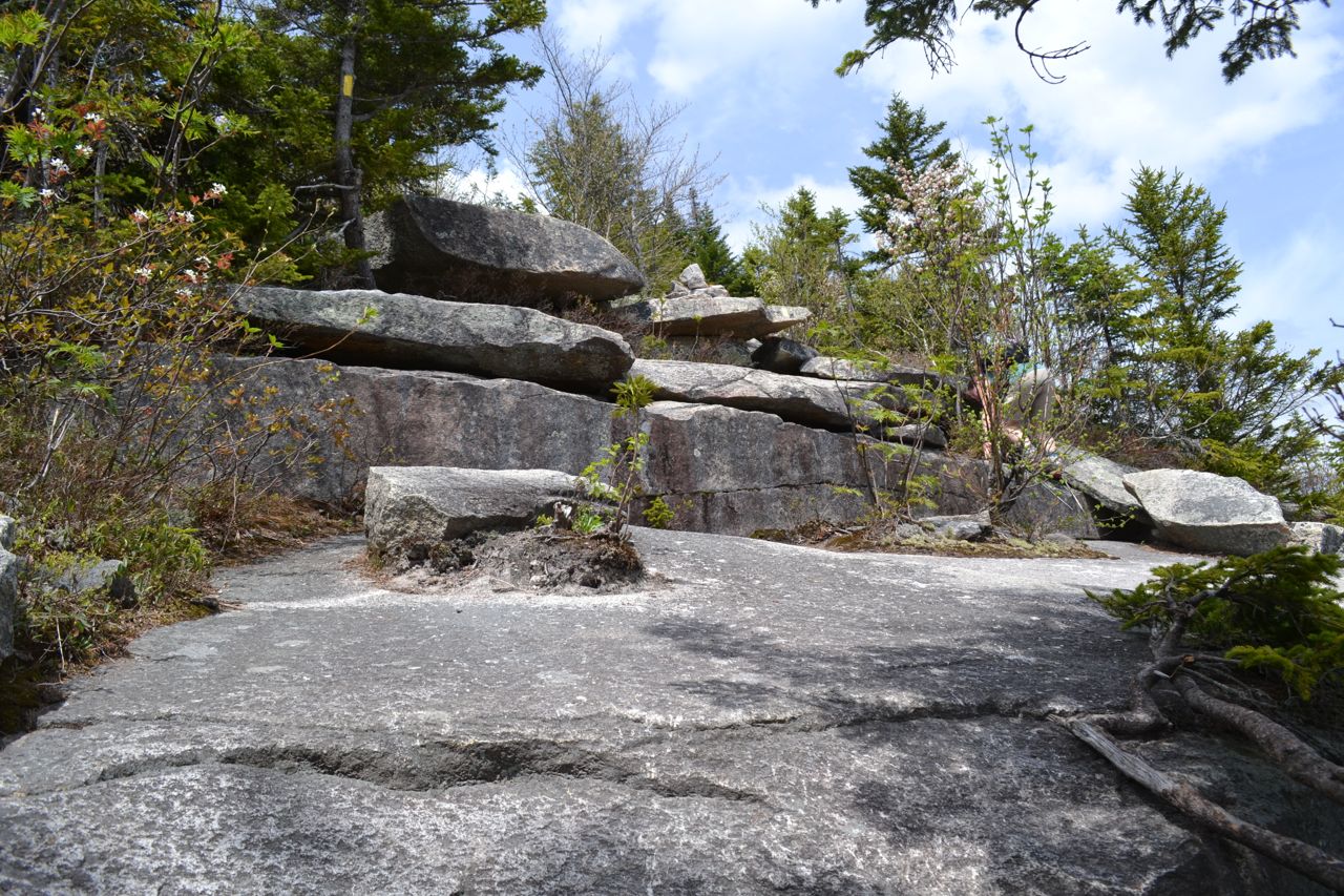
From the parking area, cross the road and walk north to the trailhead. The Baldface Circle Trail climbs a stone staircase and leads above the road for a few feet before swinging into the woods. It then begins climbing at very easy grades, over mildly rocky footing. After a pleasant forest walk of 0.7 miles, the trail arrives at Circle Junction, where it splits into a loop. Here, you will follow the south fork, but first, take a short side trip to see the lovely green-hued mini-gorge known as Emerald Pool. To see this, turn right at the sign for Emerald Pool and follow the beaten paths 0.1 miles downstream. Emerald Pool makes a nice easy hike on its own. Back at the junction, turn left onto the south fork. In 0.2 miles, turn two sharp corners, passing a trail junction with Slippery Brook Trail (turn right), then climb a few steep pitches. The trail soon assumes a moderate grade and begins the long ascent. It passes a side path to Chandler Gorge in another 0.3 miles, a detour to some cascades which adds 0.4 miles to your hike. After a mile of uneventful climbing with a few glimpses up through the trees at Eastman Mountain and Baldface Knob, the trail makes a slight descent on the side of a bump called Spruce Knoll, then climbs past a spring to the flat area between Spruce Knoll and the slopes of South Baldface. Here, the trail swings around South Baldface Shelter and climbs up a rock slab with a view of Spruce Knoll. In a few yards, the trail emerges at the bottom of the extensive open ledges on the east ridge. Once you climb to the top of this ledge, the first view (toward Evans Notch) will open up. The trail now makes an extremely steep climb over these ledges which involves many tricky rock scrambles. It winds across the rock, sometimes in the scrub and sometimes in the open. The blazes here are somewhat difficult to follow, so make sure to watch for them constantly. The view improves as you climb. Once you make it past the steepest part to the crest of the ridge, you will have a good 180-degree view into Maine. The trail now moderates and swings left, climbing over the exposed rock of this treeless ridge to a wide knob. As you approach it, you will finally be able to see the summit of South Baldface. At the top of the knob is a trail junction. This is 0.5 miles from the base of the ledges; turn right to stay on Baldface Circle Trail. The trail becomes flat and heads through a small stand of trees before beginning a climb over the long, open ridge. Closer to the top, the trail heads back into the forest and continues its moderate climb. In a short distance, it emerges again in the open at the summit, 0.5 miles from the trail junction.
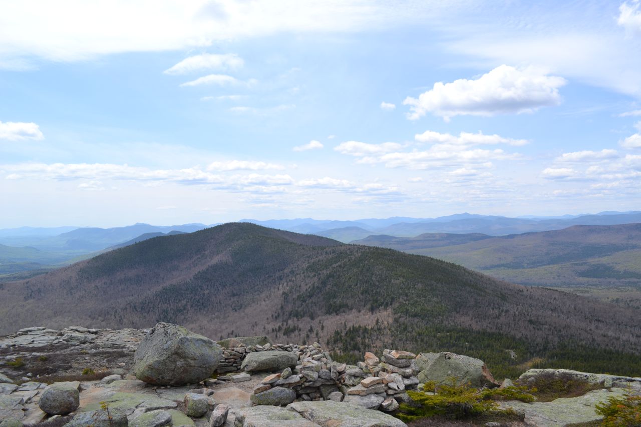
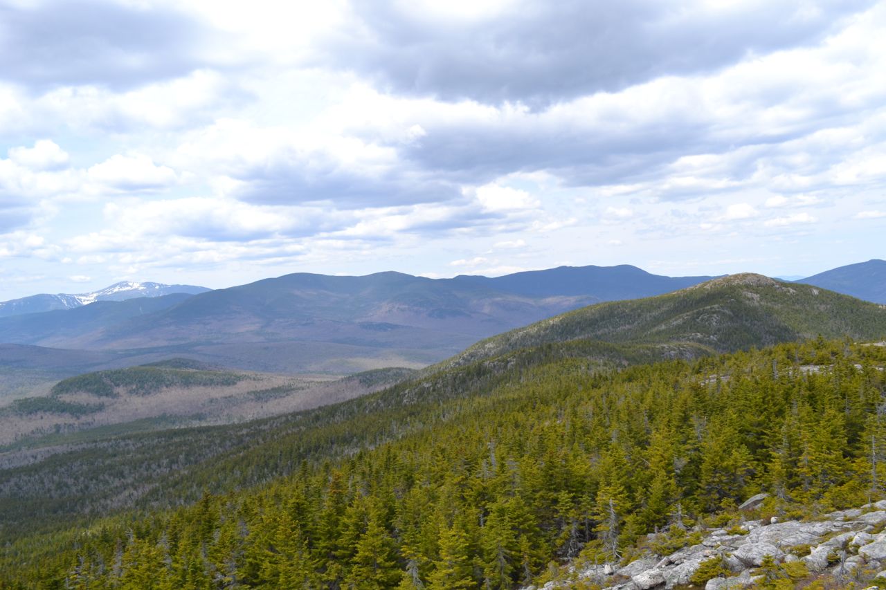
South Baldface's summit vista is breathtaking, although it is definitely the lesser of the two Baldface views. To the south are the small mountains around Mt. Kearsarge North, with Mountain Pond visible in front. Broad Sable Mountain looms close by to the southwest, with the bulk of the central White Mountains rising in the distance. The Sandwich, Moat, Southern Pemigewasset, and Twin Ranges are prominent. Across the valley of the East Branch of the Saco River is Black Mountain, with Wildcat Mountain and Mt. Washington to the right, seen above Perkins Notch and marshy No Ketchum Pond. To the northwest rises the impressive Carter-Moriah Range, across the Wild River Wilderness. A better perspective of this interesting range will be gained from North Baldface, which is seen nearby. To the north, in the distance, is the mighty Mahoosuc Range, with Evans Notch and the portion of the White Mountains in Maine closer and to the northeast. To the east is the flat expanse of western Maine, with its many lakes and ponds, including long Kezar Lake. Out of the plain rises conspicuous Pleasant Mountain to the southeast.
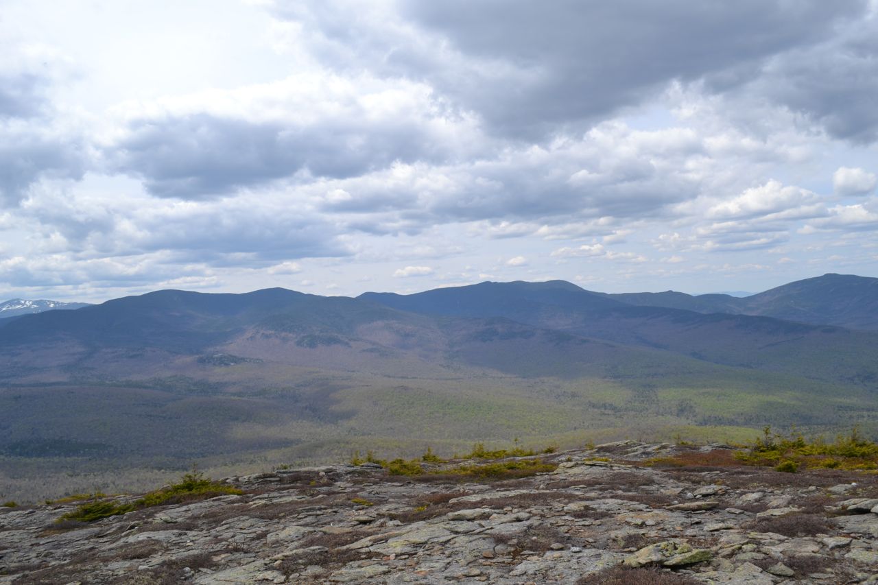
The trail leads down from South Baldface over the open rocks, where views continue, but soon dips back down into the forest. After a short walk here, it climbs back up to a minor summit sometimes called Middle Baldface, reached at 0.5 miles from South Baldface, where there are views to Mt. Washington and back to South Baldface. As you continue over a flat area, the trail swings around so you can see ahead to a sharp knob in front of North Baldface. Soon, the trail climbs up this steep slope, with several rock scrambles. It eases again at the top for the last section of climbing to North Baldface. You will reach the summit in 1.2 miles from South Baldface (or 0.7 miles from "Middle Baldface"). The view is similar here, but grander, as there is a much better look into the Wild River Wilderness; one section of the Wild River is actually visible. There is also a majestic view down the ridge leading from North Baldface to Mt. Meader, as well as an impressive view of South Baldface's barren east ridge, which the trail ascends.
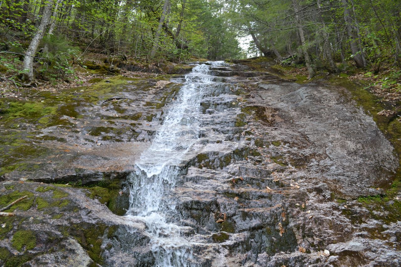
Continue across the summit on the Baldface Circle Trail. Leading down the ridge with continuing views, the trail descends moderately. In this section, there is open ledge walking mixed with steep scrambles down through the forest. After much climbing down, there are good views back at both Baldfaces. Soon the trail becomes flat, and leads toward the crest of Bicknell Ridge, where there is one last climb. Here, at 0.9 miles from the summit, you will leave the Baldface Circle Trail to descend on the Bicknell Ridge Trail. Turn right. On this trail is another long section of mixed ledge and forest descents; views of South Baldface's east ridge are particularly good here. When you reach a trail junction with Eagle Cascade Link after 0.9 miles, turn left and leave the ledges for good. This connecter trail leads down steeply through the woods, reaching Eagle Cascade, a delightful series of water slides, in 0.3 miles. The upper cascades are passed by the trail and are visible through the trees; the bottom of the cascade is reached by a spur path. After the cascade, continue on the trail for 0.4 miles to rejoin the Baldface Circle Trail and follow it downward on easier grades. After about 0.8 miles, the trail passes the confluence of two brooks and follows the combined brook downstream for 0.6 miles, until it crosses this brook just before returning to Circle Junction.
Printable directions page